


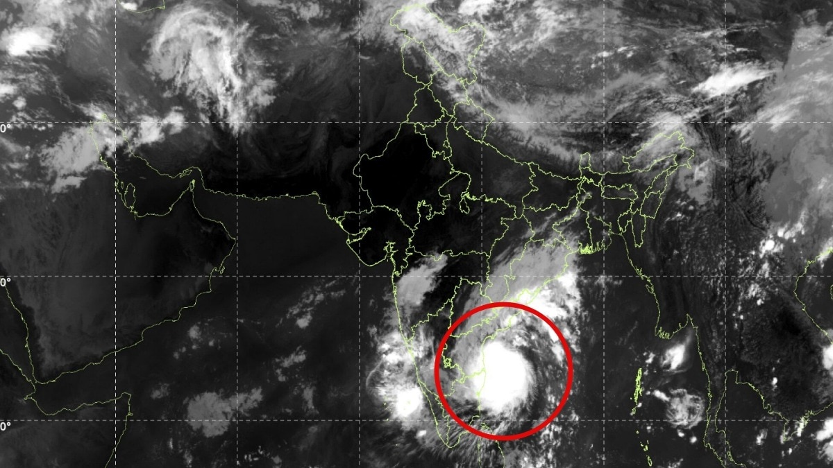
The IMD expects Cyclone Murasu to cross the south Andhra Pradesh coast early on November 3. Populated coastal districts face destructive winds, extreme rainfall and possible flooding.The weather department has warned that isolated places in coastal Andhra Pradesh, Yanam and Rayalaseema could receive extremely heavy rainfall.
Severe Cyclonic Storm Murasu is hurtling towards India's east coast, with the India Meteorological Department (IMD) tracking its movement minutely.The approaching cyclone has also triggered warnings of intense rainfall across several southern and central Indian states, with the IMD warning of heavy to very heavy precipitation over coastal Andhra Pradesh, Rayalaseema and Telangana on November 2 and 3.Tamil Nadu is also likely to receive heavy to very heavy rainfall on November 2.The weather department has warned that isolated places in coastal Andhra Pradesh, Yanam and Rayalaseema could receive extremely heavy rainfall on November 2 and 3. Telangana is also under an extremely heavy rainfall warning for November 3.
WHEN AND WHERE WILL CYCLONE MURASU ENTER INDIA?IMD is forecasting Cyclone Murasu's landfall along the south Andhra Pradesh coast between late Monday night and the early hours of Tuesday, November 3.According to the IMD, Murasu is likely to move northwestwards and cross the coast between Nellore and Narsapur, to the south of Ongole, as a severe cyclonic storm. The landfall window is expected between 11:30 pm on November 2 and 4 am on November 3.
The storm is expected to pack sustained wind speeds of 100-110 kmph, with gusts reaching up to 120 kmph. Such strong winds can damage vulnerable structures, uproot trees, disrupt electricity supplies and affect road and coastal transport.
Windy The combination of intense rainfall and strong winds could lead to waterlogging, flash flooding in vulnerable areas, disruption of transport and damage to infrastructure. Low-lying areas and communities along the coast are likely to be particularly vulnerable.The rainfall associated with the system is already being felt across parts of the country.
In the 24 hours ending at 8:30 am on November 2, Tamil Nadu and Madhya Maharashtra recorded heavy to very heavy rainfall, with precipitation ranging between 12 and 21 cm.Heavy rainfall of 7-11 cm was also recorded in parts of Assam, Odisha and Kerala during the same period.WHAT MAKES THE LANDFALL SIGNIFICANT?The forecast landfall corridor places several populated coastal districts of Andhra Pradesh in the path of the storm.With winds potentially reaching 120 kmph and the possibility of extremely heavy rainfall, preparedness and timely evacuation from vulnerable locations will be crucial.Authorities will also need to monitor river levels, drainage systems and low-lying settlements as the cyclone approaches.The next few hours will be critical as Murasu moves towards the coast. Changes in its track, intensity and speed could influence the timing and location of landfall, as well as the distribution of rainfall across southern India.- Ends